These are some projects I am currently working or have worked in the past:
Projects
Climate Adaptation
Flooding,
Transport,
Wellbeing,
Reinforcement Learning
Reinforcement learning–based decision-support framework to help cities plan long-term adaptations to pluvial flooding under climate uncertainty. Integrating rainfall projections, flood modeling, and transport simulations in an integrated assessment model, the framework learns adaptive infrastructure investment strategies that balance costs with avoided disruptions to urban mobility. Applied to a case study of Copenhagen (2024–2100), the approach identifies coordinated spatial and temporal adaptation pathways and outperforms traditional optimization methods. The results highlight the potential of reinforcement learning to support resilient infrastructure planning in cities facing increasing climate risks.
Cycling Safety
Objective Cycling Safety,
Subjective Cycling Safety
Cycling safety is a key factor in encouraging more people to adopt cycling as a sustainable mode of transportation. It can be understood through both objective safety, which refers to measurable indicators such as crash rates and infrastructure characteristics, and subjective safety, which captures how safe individuals perceive cycling environments to be.
Analyzing Cycling Accidents
Cycling accidents,
Latent Class Discrete Outcome Model,
Authoritative and Open Data,
Econometrics and Machine Learning
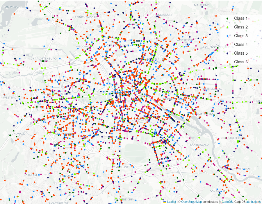
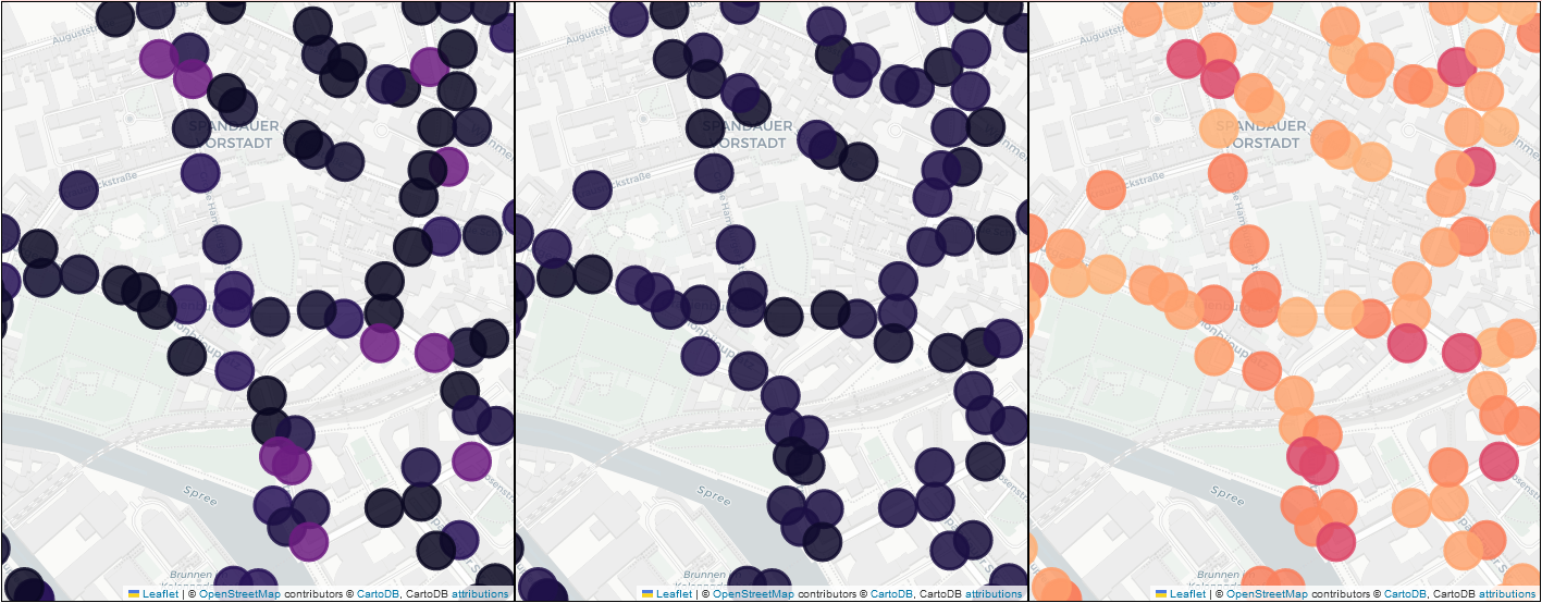
This study examines the factors influencing cycling accident severity and how they relate to the built environment. Using accident data from Berlin combined with volunteered geographic information, we develop a modeling framework that integrates machine learning and econometric methods through a latent class discrete outcome model. The approach identifies different built environment contexts in which accidents occur and reveals how risk factors vary across these contexts. By capturing this heterogeneity, the model helps uncover complex relationships between urban environments and accident outcomes, providing insights that can support targeted safety interventions and more effective cycling policies.
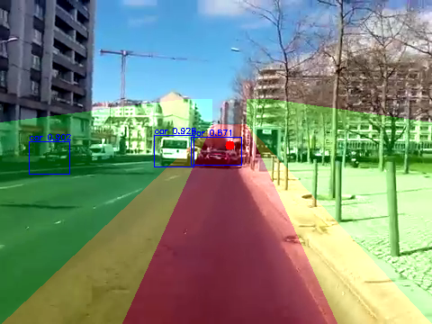
Perception of Cycling Safety
PCS-Net,
Perception of cycling safety,
Pairwise Comparisons,
Siamese Convolutional Neural Network
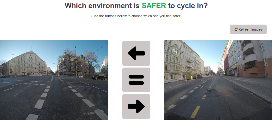
This study develops a new approach to measure how people perceive cycling safety in urban environments. Instead of relying on traditional surveys, participants were shown pairs of real-world street images and asked to select which environment appeared safer for cycling. The responses were used to train a siamese convolutional neural network capable of learning safety preferences directly from images, including situations where participants perceived both environments as equally safe. The resulting model can predict human perceptions of cycling safety and enables scalable, continuous assessments of street environments, supporting more effective interventions to improve cycling conditions in cities.
CYCLANDS
Cycling geo-located accidents, their details and severities
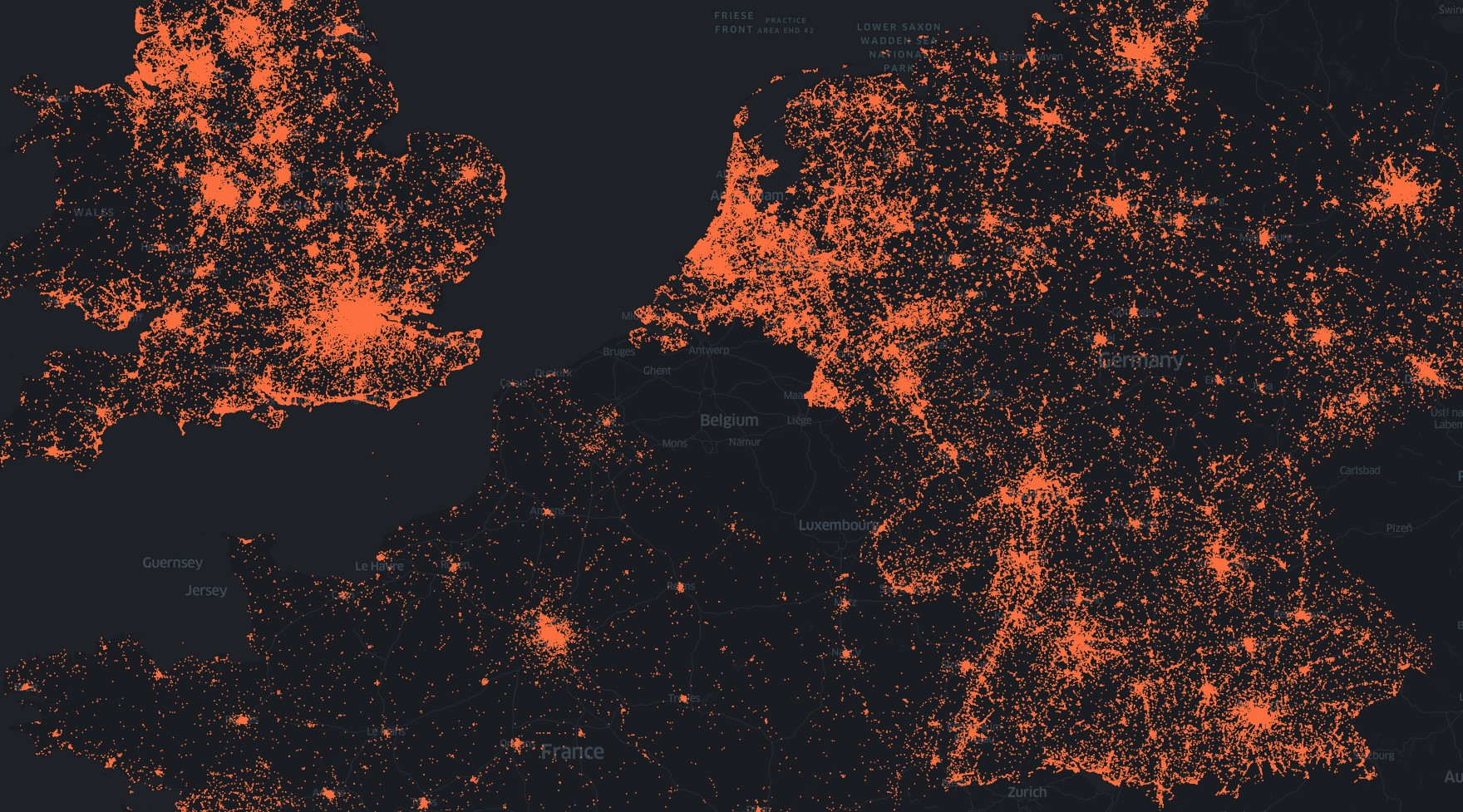
CYCLANDS is a curated collection of 30 datasets on cycling crashes to lower the barrier in objective cycling research comprising nearly 1.6M cycling accidents. This data is vital for road safety analysis, enabling researchers to develop models to understand how different factors impact the frequency and severity of accidents. Observations include the severity and location of the accident, aiming to foster the worldwide study of cycling safety by providing a testbed for researchers.
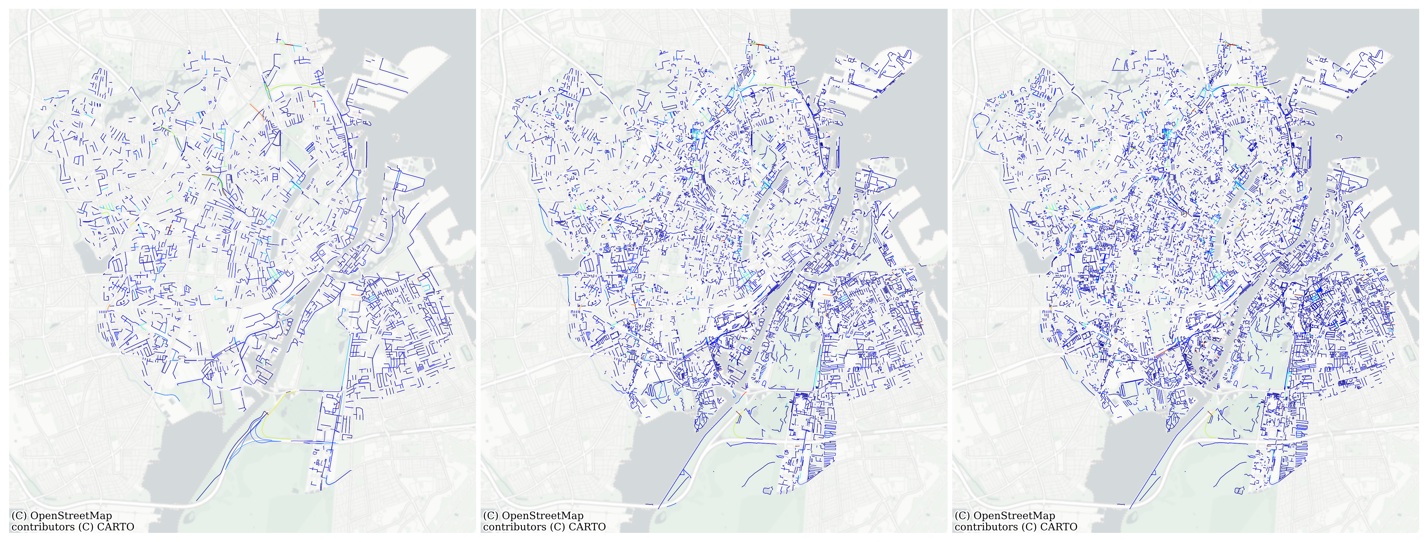
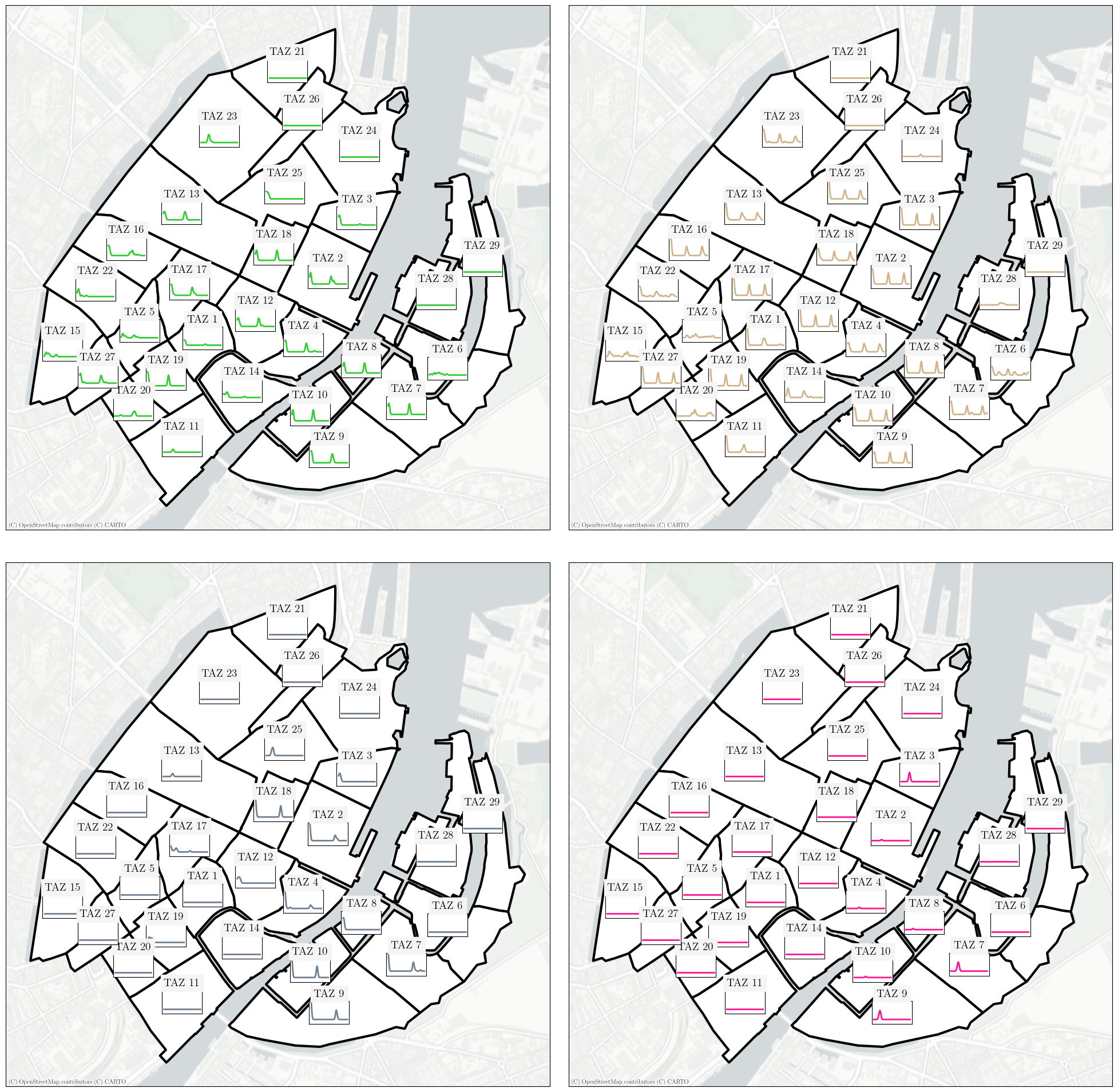
Circuity Analysis
Urban Form,
Urban Street Networks,
Driving, Cycling, Walking
Circuity, the ratio of network distances to straight-line distances, is considered a critical measurement in urban network morphology and transportation efficiency as it can measure the attractiveness of routes in terms of distance traveled.
Circuity and Mobility Cultures
European Cities,
Urban Street Networks,
Cycling Infrastructure Changes,
Accessibility
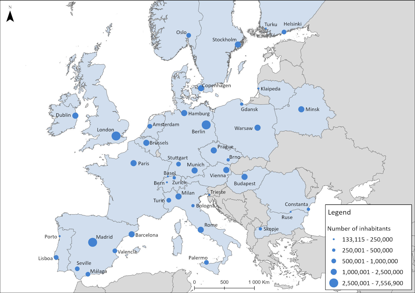
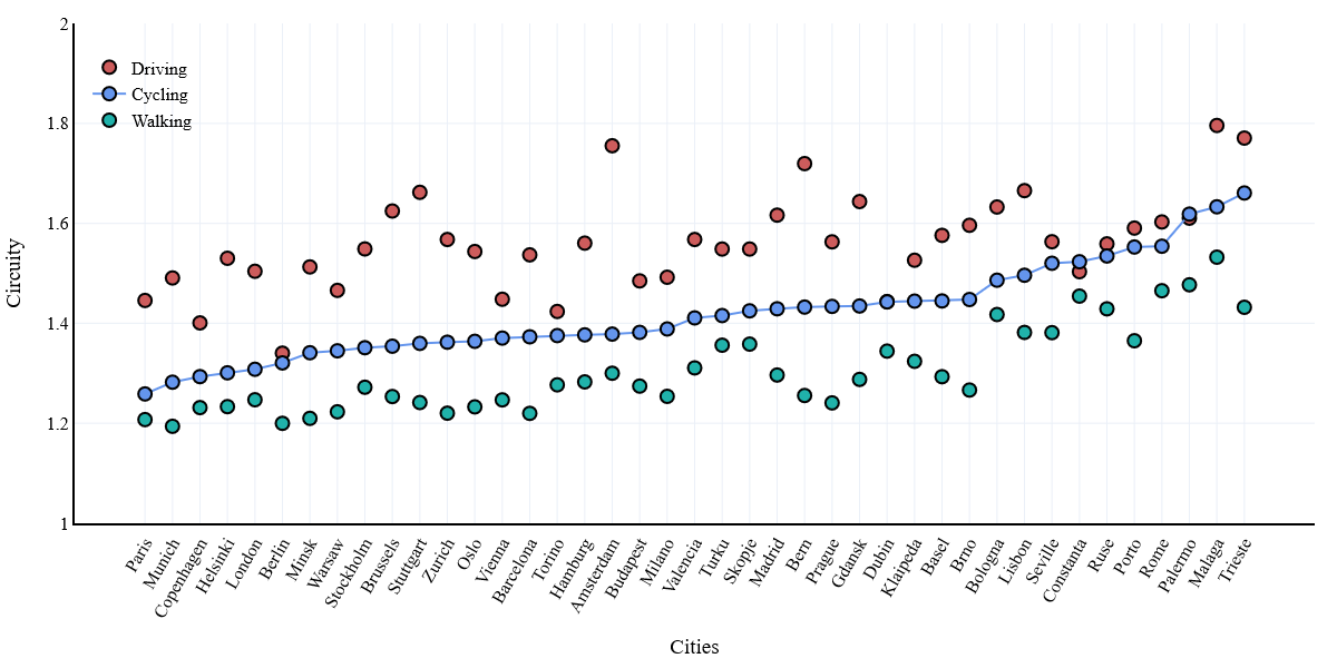
This research explores how street network efficiency relates to mobility patterns across 41 European cities by comparing circuity levels for walking, cycling, and driving networks. Using data-driven clustering, cities were grouped into six distinct mobility cultures, such as Cycling Champion Cities, Sustainable Transportation Advocates, and Car Dependent Cities. The analysis reveals significant differences in network efficiency across these groups, with car-dependent cities showing the highest circuity and sustainable mobility cities the lowest. By linking urban network structure with mobility culture, the study provides a benchmark for cities seeking to improve transportation efficiency and transition toward more sustainable mobility systems.
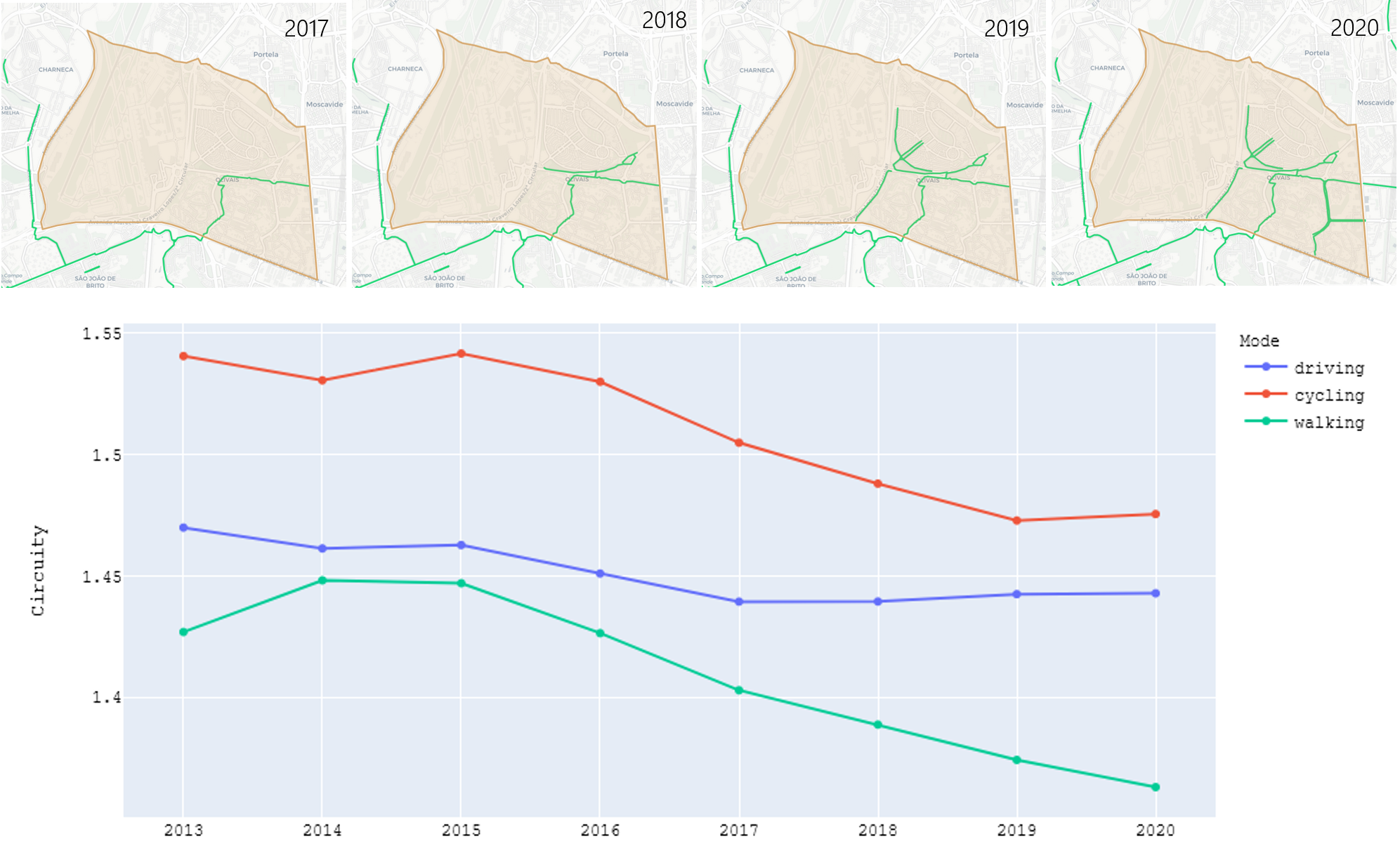
Lisbon's Circuity Analysis
Temporal Evaluation,
Network Evolution,
Cycling Infrastructure Changes,
Accessibility
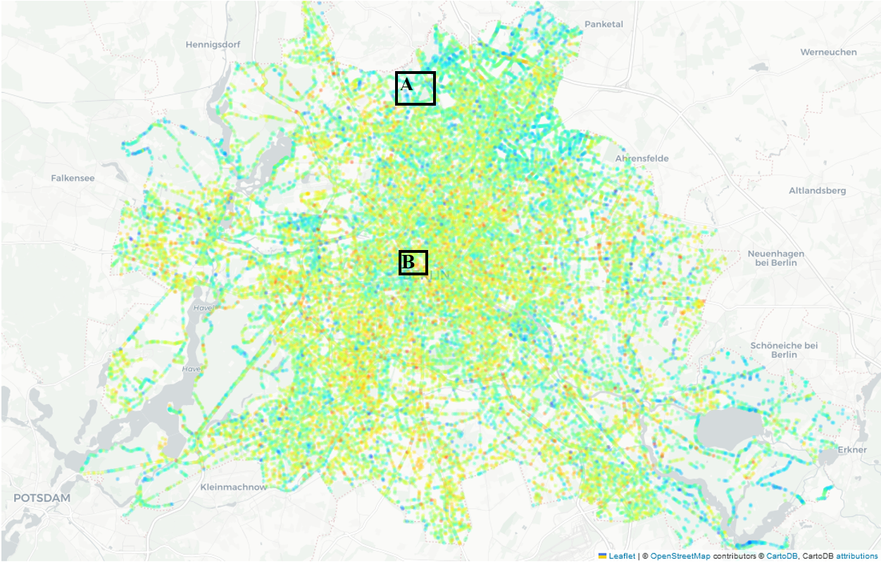
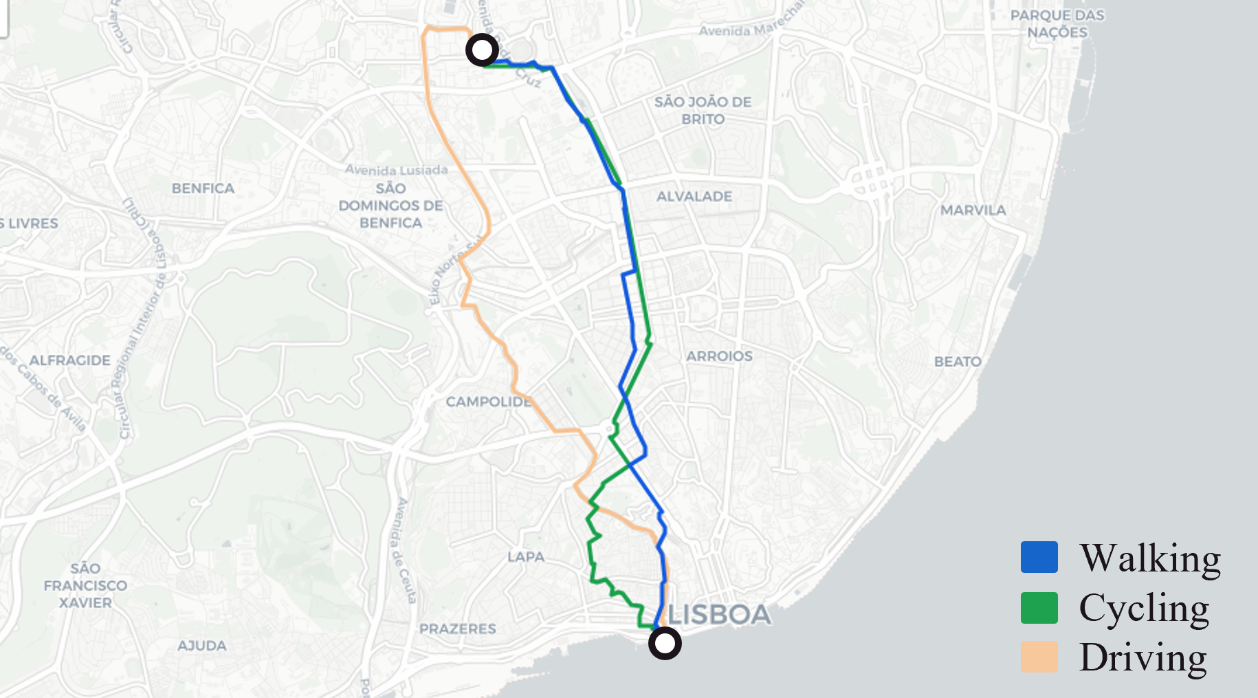
This study examines how the structure of urban street networks influences mobility by analyzing circuity for Lisbon between 2013 and 2020. We simulated 4.8 million routes across driving, cycling, and walking networks to understand how circuity evolves over time and differs across transport modes. The results show that each mobility network has distinct structural characteristics and should therefore be analyzed separately in urban planning and modeling. In particular, Lisbon's recent expansion of cycling infrastructure significantly improved the efficiency of cycling routes. The research demonstrates that circuity is a valuable indicator for identifying where urban interventions can make active travel modes more attractive and support more sustainable mobility systems.
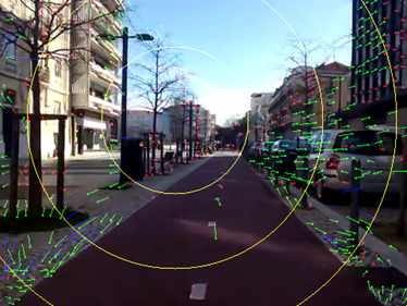
Smartbike
Cycling,
Perception of Safety,
Focus of Expansion,
Android App
Development of different metrics to assess the risk perception of a cyclist when riding a bike in cities. The trajectory of the cyclist is considered, as well as other stationary or moving objects in its vicinity, its change in speed, acceleration and its geographic positioning (given by the smartphone) and the effort/stress of the rider, by analyzing their heart rate variability in an ECG.
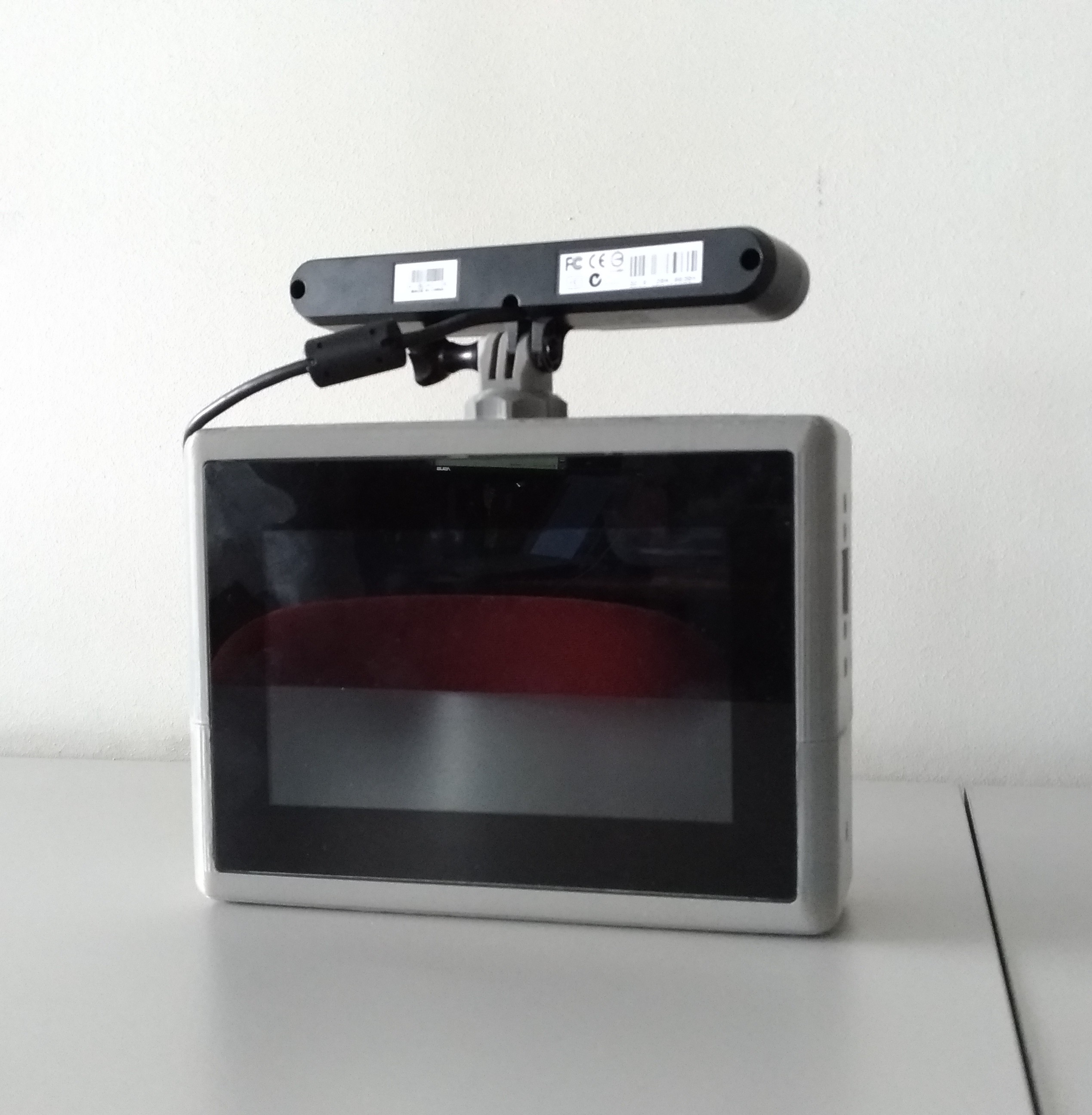
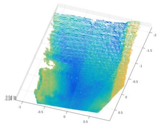
Walkbot
Walkability,
Sidewalk Evaluation,
RGBD Processing
Development of a device capable of automatically digitalize and map a network of sidewalks in a city. These scans allow for the further development of support applications with the objective of guiding pedestrians in cities with various mobility needs. This project was funded by Thales TecInnov 1st Edition.